TrailSnag.

The steward desk

What a steward does, screen by screen.

This is the real desk, not a mockup: every image below is a screenshot of the running product, on the demonstration territory of a fictional organisation.

Sign in with Google, a password, or a code sent to your email.

trailsnag.app/steward/…
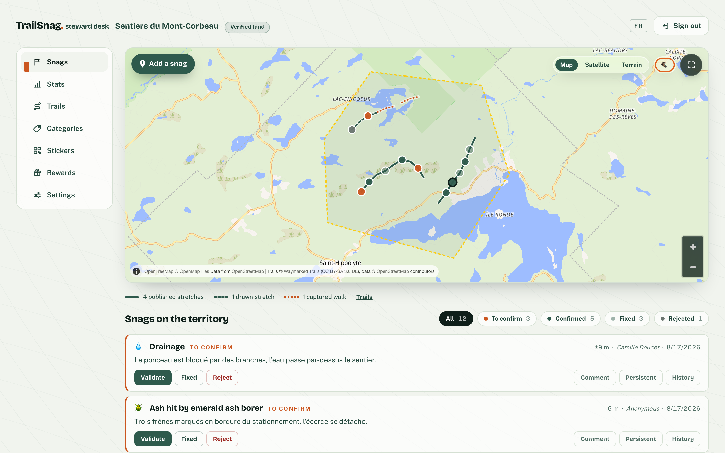
The triage queue: the territory map with geolocated reports, then twelve reports with their state — to confirm, confirmed, fixed, rejected.

A triage queue, not an inbox

Every report lands geolocated and photographed on your territory’s map. Validate, fix, close — the history stays, and an hourly email digest keeps every member who wants it in the loop.

trailsnag.app/steward/…/trails
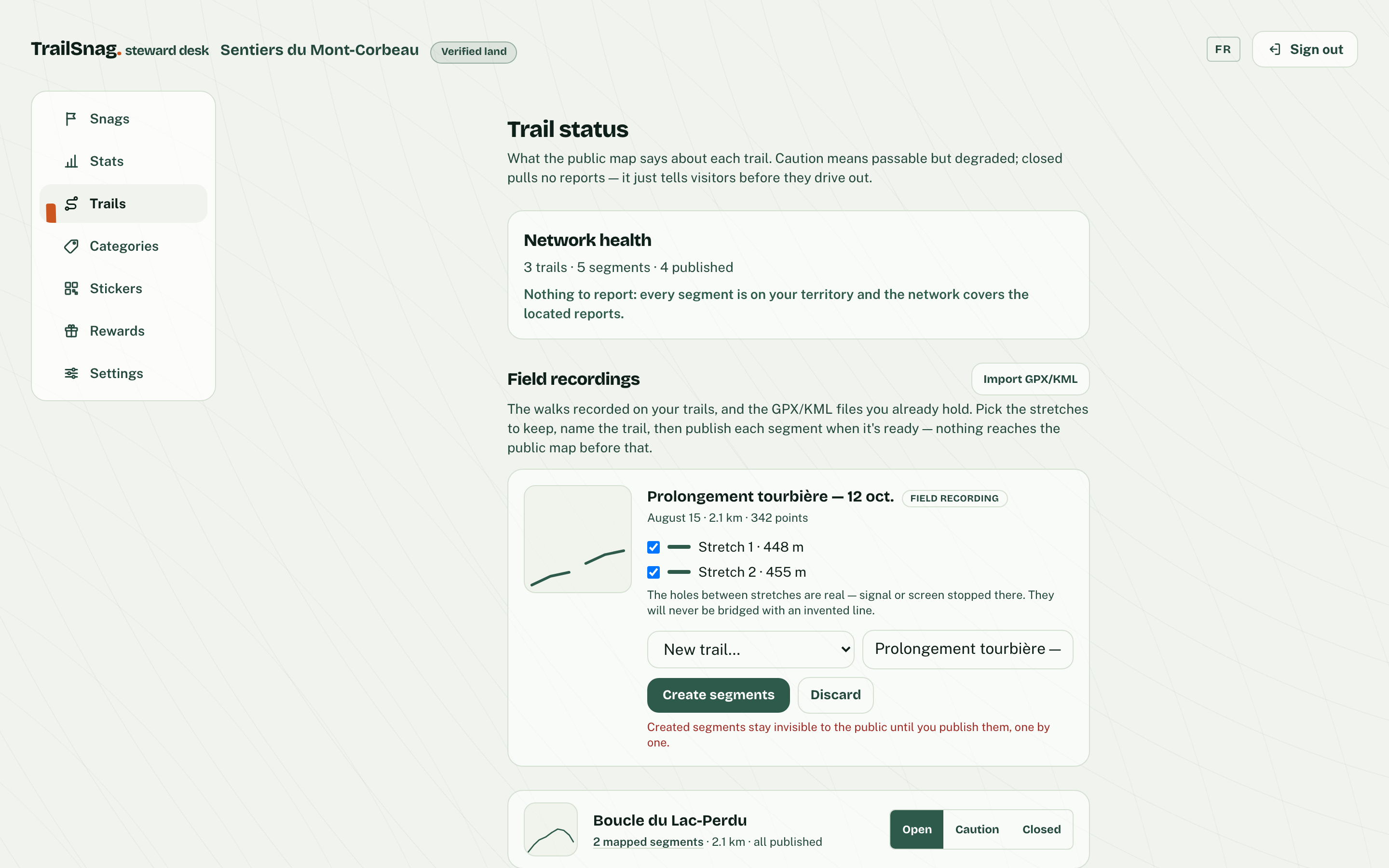
The trails screen: the network report, a captured walk waiting to be promoted with its two stretches, and each trail’s open/caution/closed status.

Your trails, traced by you

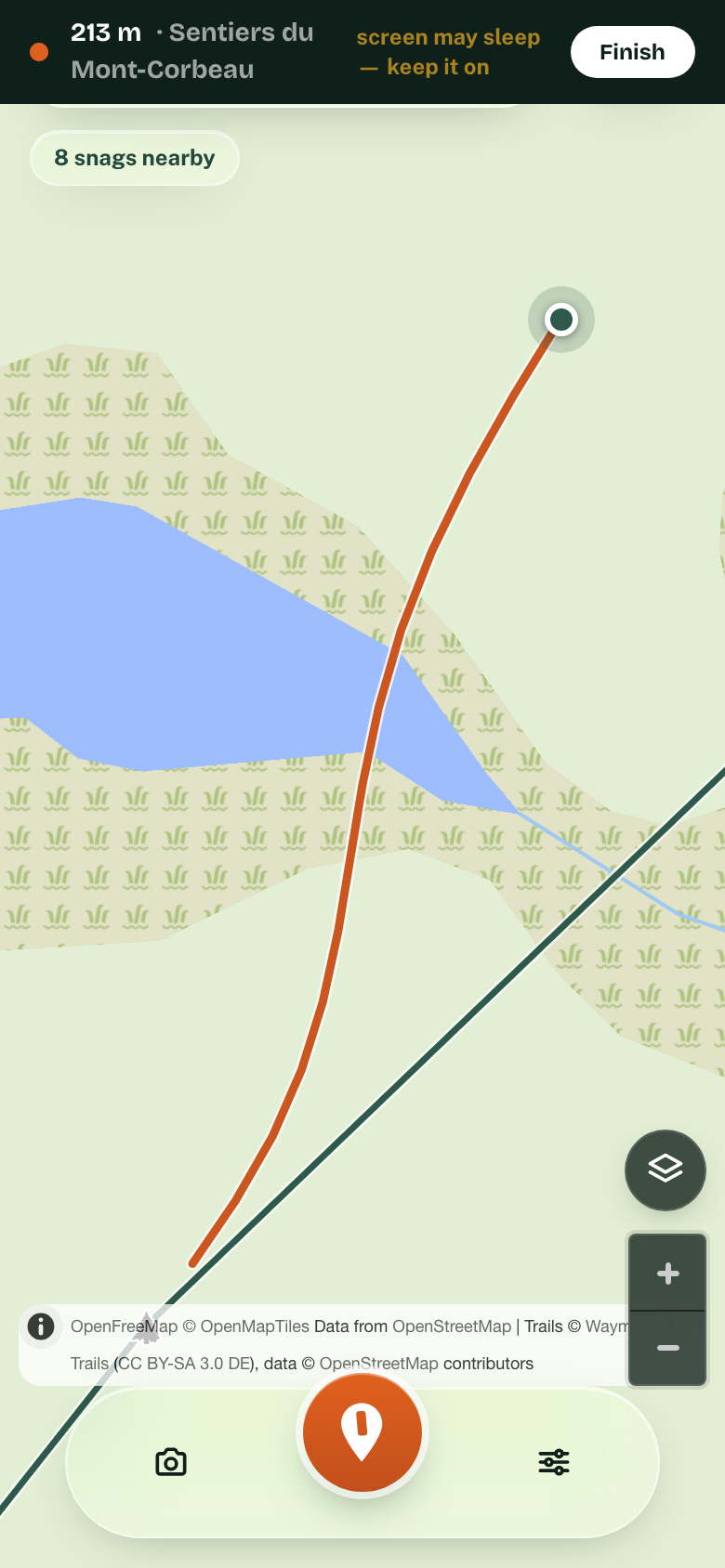
Walk a trail and the phone captures the line — even with no signal. At the steward desk, make it the official route or draw it by hand, publish it to the public map when it is ready — and a report tells you what is missing.

A phone recording a walk: 213 m captured, the orange line following the trail, and the warning to keep the screen on.
trailsnag.app/steward/…/categories
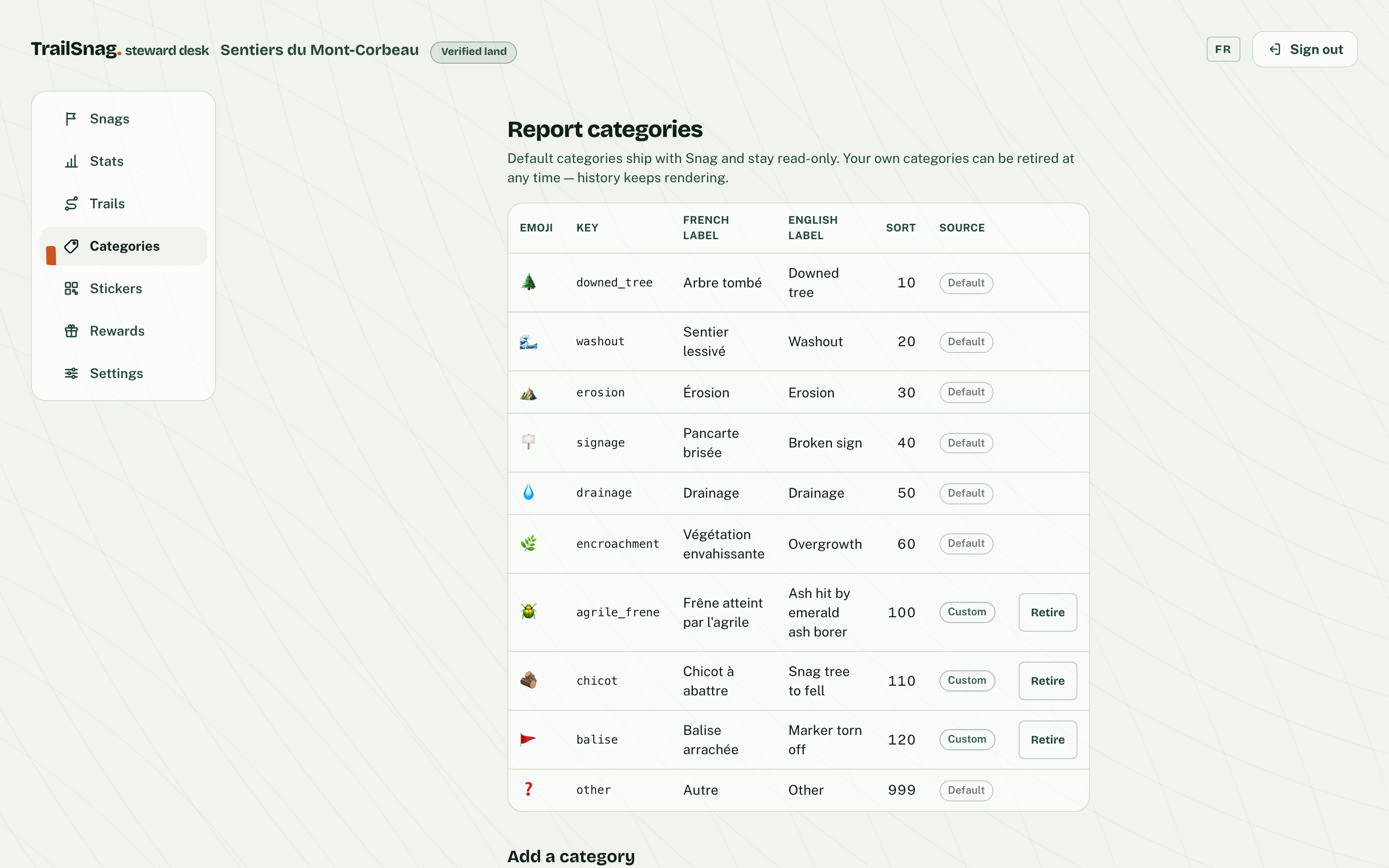
The org’s report menu: the default categories followed by its own — ash hit by the emerald borer, dead snag to fell, torn-off blaze — in French and English.

Your categories, down to the tree species

The report menu is yours: add your own categories — an ash hit by the emerald borer, a dead snag to fell, a torn-off blaze — in French and English. Visitors report in your words, and retiring a category never erases the history.

trailsnag.app/steward/…/stats
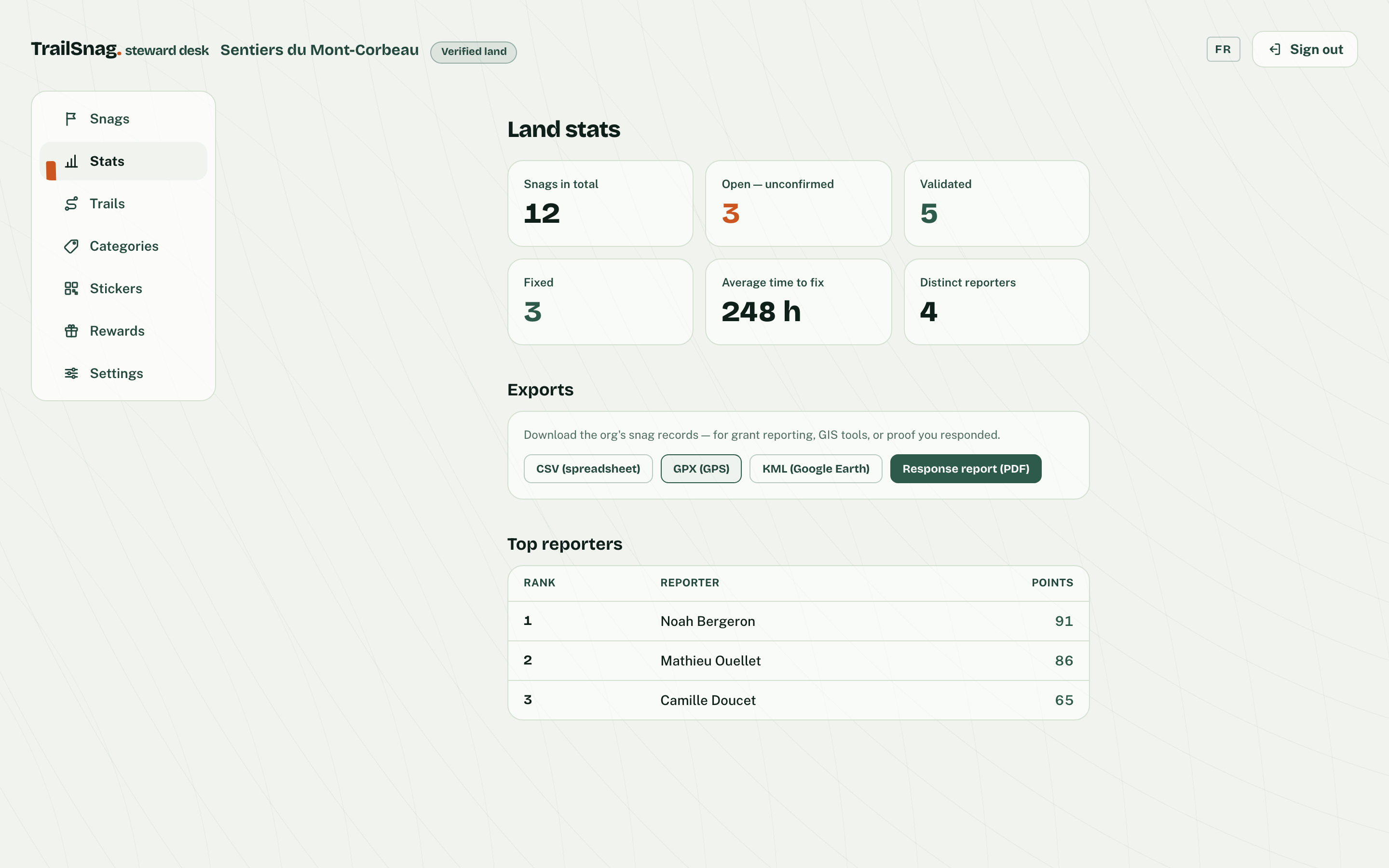
Territory stats: total reports, open, validated, fixed, average time to fix, then the CSV, GPX, KML exports and the intervention-report PDF.

Proof you responded

The public map shows what’s reported and what’s resolved. Export the log as CSV, GPX or KML for your grant files — and produce an intervention-report PDF, problem by problem.

trailsnag.app/steward/…/rewards
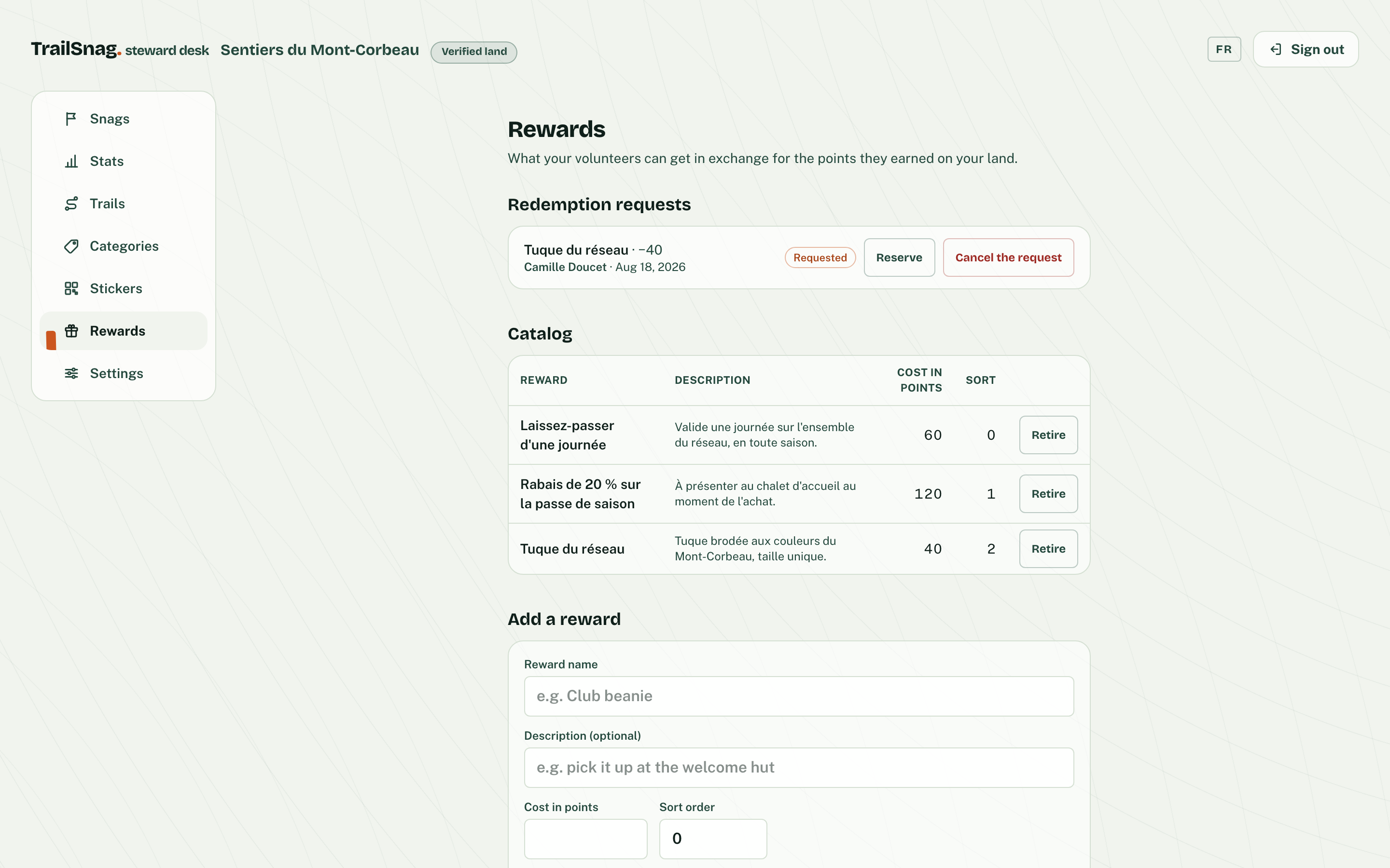
The reward catalog: day pass, season discount, network toque, and one redemption request awaiting a decision.

Volunteers, rewarded

Validated fixes earn your volunteers points — and your crew decides what they’re worth: a free pass, a discount, gear in your colours. You set the catalog, TrailSnag keeps the ledger.

QR stickers, one per trailhead

Print them yourself from the steward desk: a print-ready file sized for adhesive vinyl, one code per trailhead — that is the whole install. No kiosk, no hardware, no visitor training.

trailsnag.app/steward/…/settings
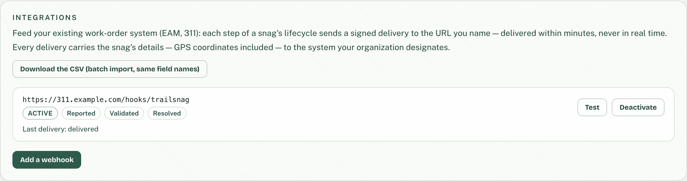
The Integrations section: an active 311 endpoint, the lifecycle steps it receives, a Test button, and the last delivery.

Feeds the tools you already run

Every step of a report’s lifecycle can feed your 311 or work-order system — a signed feed you can test in one click, plus CSV import with the same field names.

Your trails’ status, shown everywhere Coming soon

Declare each trail open, caution or closed: the public map colors the line, and a one-line embeddable map shows it all on your own website.

Your territory, on your word

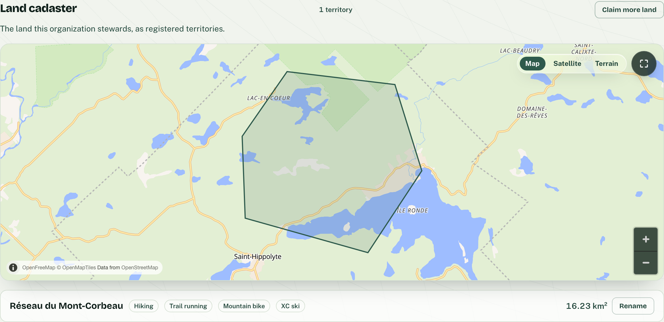
Claim your land by drawing it on the map: the desk opens only on the territory you steward, and the reports that land inside it come to you.

Claim your land
trailsnag.app/steward/…/settings
The org’s land record: its territory drawn on the map, with the network name, the sports practised and the area.

What it takes to start

Claim your land, print one sticker per trailhead, and every visitor becomes a pair of eyes for your crew. Work from today, verification comes after.