Volunteer clubs and committees
Your trails, your report queue, your volunteers credited. The free tier costs nothing, has no end date, and asks for no interview.
For trail stewards
A QR code at the trailhead, and every hiker reports a problem to you in 30 seconds — geolocated, photographed, with no account and no app to install, even with no signal. Your crew gets it in a triage queue, on the map of your land.
The free tier has no end date, whatever your organisation is. Just visiting? Reporting needs no account.
Un problème sur le sentier ?
Spot a problem on the trail?
Scannez — 30 secondes, sans compte.
trailsnag.app
The sticker at the trailhead — that is all the visitor has to do.
No sticker in reach? Open the app
For stewards
TrailSnag turns every visitor into a pair of eyes on the ground — and gives your crew a triage queue to act.
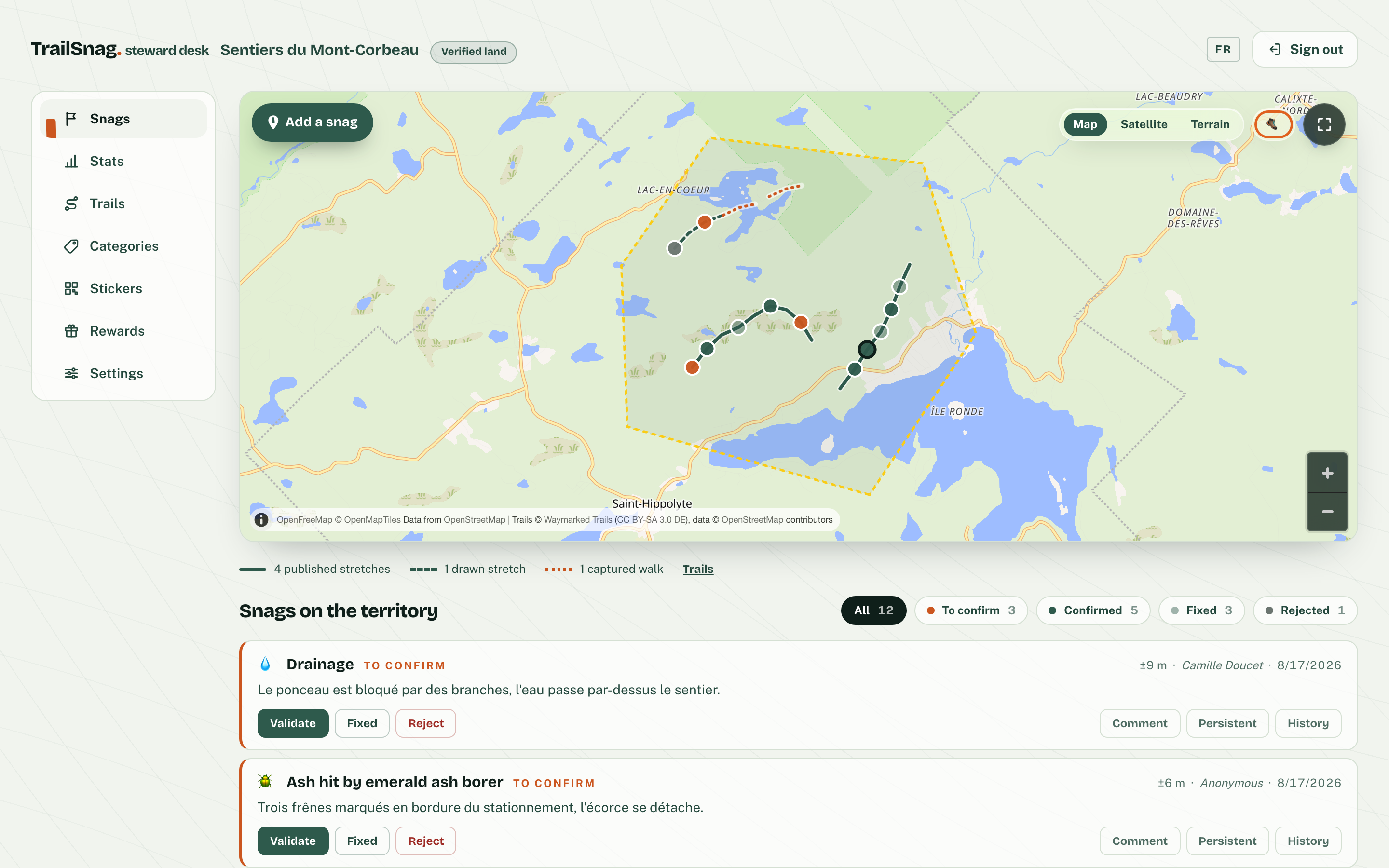
Every report lands on your territory’s map, with its position and, more often than not, a photo. Validate, fix, close — the history stays, and an hourly email digest keeps managers and owners in the loop.
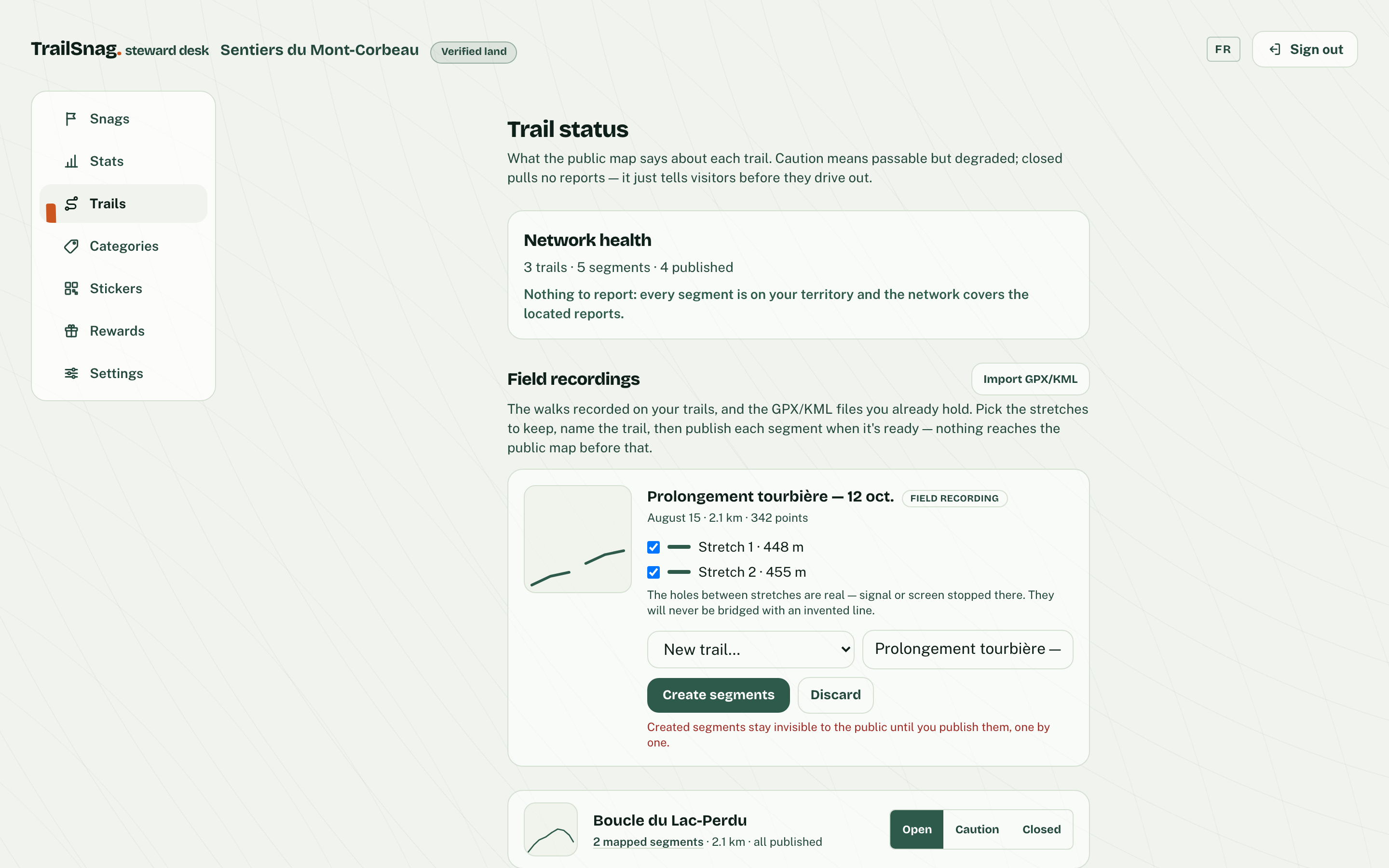
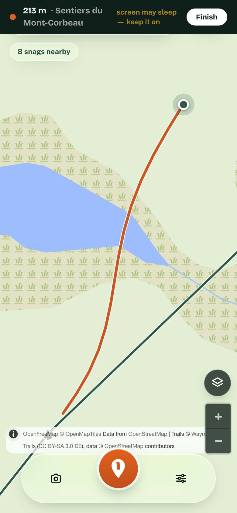
Walk a trail and the phone captures the line — even with no signal. At the steward desk, make it the official route or draw it by hand, publish it to the public map when it is ready — and a report tells you what is missing.
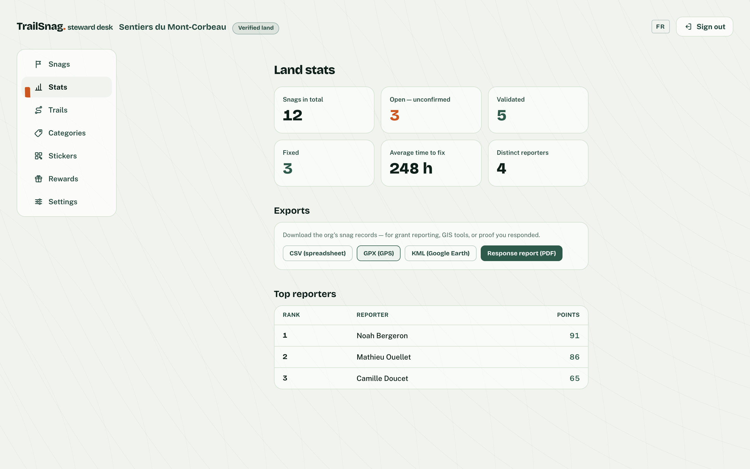
Open your public map when you choose to: it then shows what is reported and what is resolved. Export the log as CSV, GPX or KML for your grant files — and produce an intervention-report PDF, problem by problem.
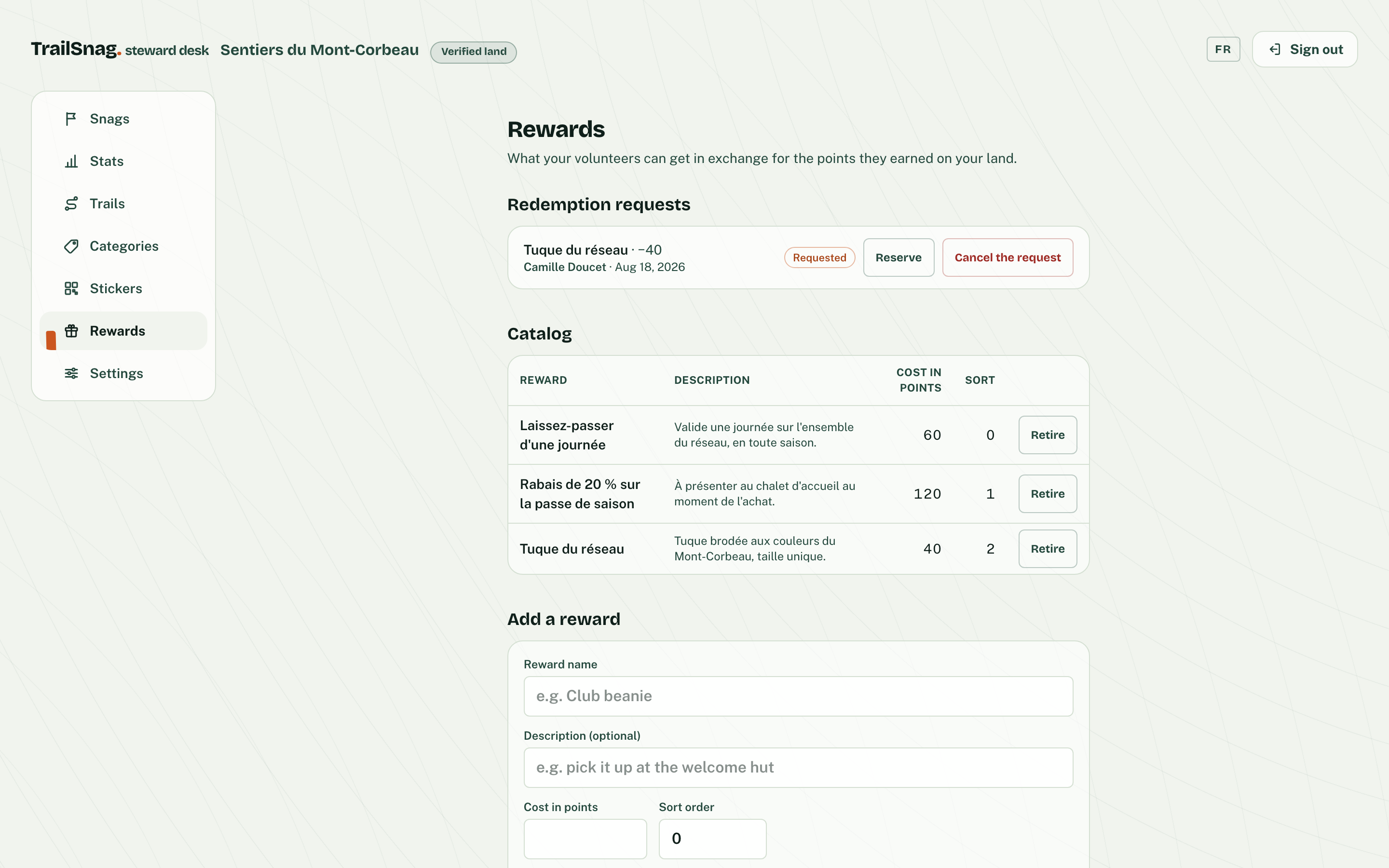
A validated report earns points for the person who reported it — and your crew decides what they’re worth: a free pass, a discount, gear in your colours. You set the catalog, TrailSnag keeps the ledger.
And also
The report menu is yours: add your own categories — an ash hit by the emerald borer, a dead snag to fell, a torn-off blaze — in French and English. Visitors report in your words, and retiring a category never erases the history.
Print them yourself from the steward desk: a print-ready sheet straight from the browser, sized for adhesive vinyl, one code per trailhead — that is the whole install. No kiosk, no hardware, no visitor training.
The key steps of a report’s lifecycle — created, validated, resolved, rejected — go to an address you choose — a signed feed you can test in one click, which your 311 or work-order system can receive.
Declare each trail open, caution or closed: the public map colors the line, and a one-line embeddable map shows it all on your own website.
Sign in with Google, a password, or a code sent to your email.
Who it serves
Your trails, your report queue, your volunteers credited. The free tier costs nothing, has no end date, and asks for no interview.
Your land, your log, your words: trace your own trails, mark the ash hit by the borer, the dead snag to fell, the fence to mend. You are your own crew — and nothing gets lost, even offline.
A channel that takes your visitors’ reports and documents your diligence, season after season. The rate follows your legal form — public bodies and non-profits on one side, businesses on the other — never your area.
Trails are the blind spot of 311. TrailSnag routes reports to the crew responsible for the land — not to a generic queue.
Comparing a few tools? See what exists, and where we differ
What your visitors do
The QR code at the trailhead opens the map in your browser, where you are standing. Nothing to install, nothing to sign up for.
A category, a photo if you want one. The GPS position is captured on its own.
No signal in the woods? The report is kept on the phone and sends itself when the network comes back.
Want your points to follow you across devices? Create an account in the app. Reporting never asks for one; only redeeming a reward does. And your photos are scrubbed of their hidden metadata (position, device) before they even leave your phone.
Your volunteers, rewarded
Every confirmed report and every validated fix earns points for the person who did it. Your crew decides what they are worth — a day pass, a discount, a t-shirt in the club’s colours — and TrailSnag keeps the ledger.
Points come from real trail work: a report confirmed by the community, a fix validated by the crew. No quizzes, no draws.
A free day pass, a season-pass discount, the club t-shirt: each verified steward publishes its own rewards and honours them itself.
The reward comes from the steward of the territory you helped — the centre, the club, the landowner. Your effort goes back to the trail’s community, and it gives back.
Each verified steward decides its own catalog; the points add up from the first report.
Claim your land and every visitor becomes a pair of eyes for your crew — work from today, verification comes after.
Just visiting? Report an issue now
A question before you start? Book a 30-minute call
or write to us: bonjour@trailsnag.com